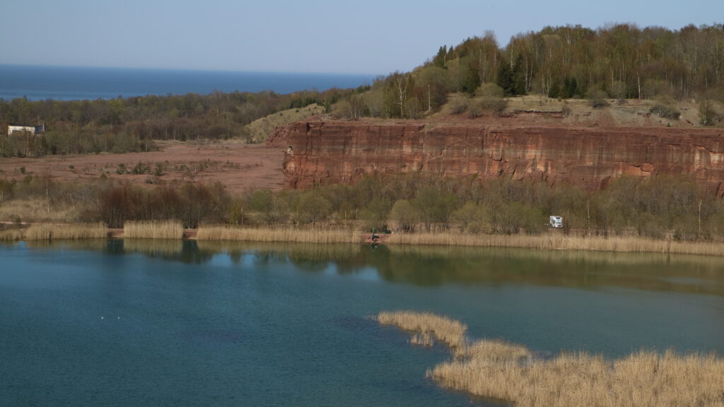
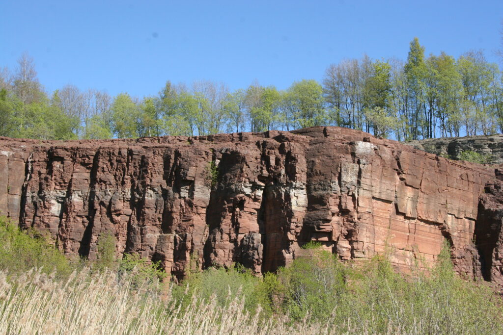
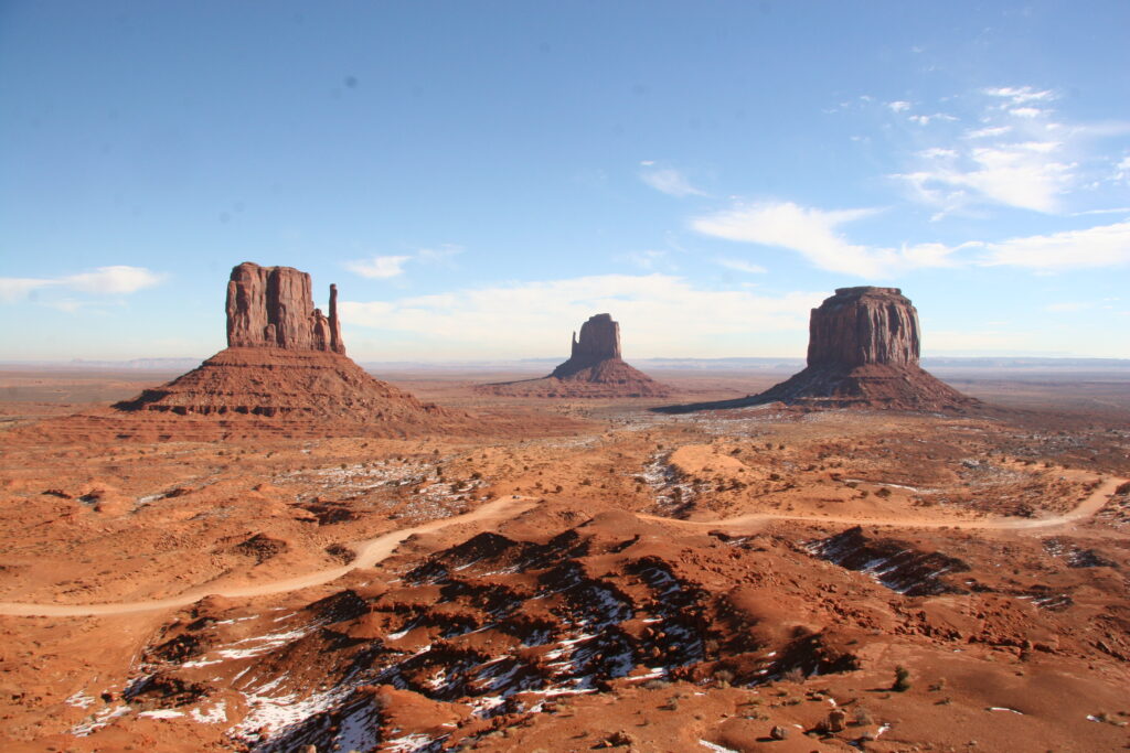
Like the famous red mesas of the American Southwest, the Paleozoic plateaus in south-central Sweden between Trollhättan and Skövde are remants of laterally extensive layers of sedimentary rocks. This ‘sheet cake’ of layers has been eroded over 10’s to 100’s of millions of years so that only the remaining plateaus, the ‘last pieces of the cake,’ are left. From the bottom to the top, the layers (sandstone, shale, limestone, another shale, and basalt) record several hundred million years of Earth history, from the Cambrian to the Permian Period. At that time, plate-tectonic movements placed Sweden south of the equator, so the rocks were formed in a near-tropical environment. It is possible to find fossils in these rocks, trilobites and the well-known orthocerous, famous because it is in the limestone (quarried at Kinnekulle) that is used in flooring in many Swedish public buildings.
But the more subtle and more startling geologic feature of the area is the flat surface upon which the plateaus stand. The landscape between the plateaus is strikingly flat, a feature that geologists call a ‘peneplain’ (meaning ‘almost a plain’). The origin of this surface is not well understood, but it is clearly formed by erosion long ago. In fact, this flat surface, upon which we see today the farmers’ fields, was a flat surface already 500 million years ago, before the old Cambrian sandstone in the plateaus was laid down. That is, the rocks in the plateaus were laid down upon this eroded surface, so it has been referred to as the Subcambrian peneplain. This flat surface has now been uncovered to how it looked 500 million years ago by the removal of the ‘sheet cake’ of overlying sedimentary rocks. More striking is that the rocks in the peneplain (metamorphic gneiss and igneous granite) are from the roots of a Himalayan-type mountain chain. These rocks could only have been formed 20-30 km below this former mountain chain, but, through millions of years of erosion, have been planed down to the flat surface. The mountain (and the rocks under them) were formed 1600 billion years ago with the peneplain being the end result of erosion that ended 500 million years ago. Thus, walking on the peneplain, you are walking on rocks formed 20-30 km below the surface.
Finally, the region has abundant evidence from the last Ice Age, although the Ice Age did nearly nothing to shape the plateaus and the peneplain. From Skara to Götene west of Billingen and from Skövde and north, east of Billingen run a series of end moraines formed about 12,000 years ago during the final phases of the Ice Age. The quaint church at Skånings-Åsaka sites atop one of the moraines. These end moraines (ridges pushed up at the edge of the glacier) were mostly formed under water, because the ocean followed the retreat of the ice. The ocean existed here because the weight of the glaciers had depressed the crust; all of the peneplain is covered with marine clay. The region known as Valle Härad owes its topography to the last glacier; the rounded, forested hills and many lakes are a nationally known example of what is called a ‘kame landscape’ formed by buried ice from the glacier collapsing sediment forming knolls and lake basins.
The Ice Age in this area ended with a dramatic event; the drainage of the Baltic Ice Lake. When the moraines were formed, the ocean occupied the lowland to the west. But east of the plateau called Billingen, the glacier had dammed up a great lake, which filled the Baltic basin. This ‘Baltic Ice Lake’ had a lake level 25 m higher than the sea to the west. When as the ice melted back further north, it uncovered the north end of Billingen that lay at an elevation below the level of the sea. This caused the lake to drain to the west, and it was catastrophic—7000 cubic kilometers of water drained to the west in the period of about a year. Among other consequences, this drop (which was about 11,600 years ago) caused the border between Denmark and southern Sweden to be drained; this ‘land bridge’ allowed plants and animals and certainly early humans, to cross and populate southern Sweden. The Ice Age in this area ended with a dramatic event; the drainage of the Baltic Ice Lake. When the moraines were formed, the ocean occupied the lowland to the west. But east of the plateau called Billingen, the glacier had dammed up a great lake, which filled the Baltic basin. This ‘Baltic Ice Lake’ had a lake level 25 m higher than the sea to the west. When as the ice melted back further north, it uncovered the north end of Billingen that lay at an elevation below the level of the sea. This caused the lake to drain to the west, and it was catastrophic—7000 cubic kilometers of water drained to the west in the period of about a year. Among other consequences, this drop (which was about 11,600 years ago) caused the border between Denmark and southern Sweden to be drained; this ‘land bridge’ allowed plants and animals and certainly early humans, to cross and populate southern Sweden.
Mark Johnson, Associate Professor of Quarter Geology, Dept. of Earth Sciences, University of Gothenburg/Göteborgs Universitet